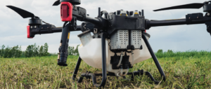
Aerial Insights, Sustainable Harvests: How Drones Could Transform Tanzanian Agriculture
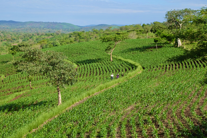
Agriculture is central to Tanzania’s economy and rural livelihoods. Millions of Tanzanians depend on farming for food, income, and employment, with crops such as maize, rice, coffee, cotton, tea, and horticultural products supporting communities across the country. However, Tanzanian agriculture faces growing challenges, including unpredictable rainfall, drought, pests, soil degradation, water scarcity, and climate change. As the country seeks to increase agricultural productivity while protecting its natural resources, drone technology could offer a promising path towards more sustainable farming.
Drones & Efficient Water Use
Agricultural drones can give farmers a detailed view of their fields that is difficult to get from the ground. Equipped with cameras and other sensors, drones can capture images that reveal differences in crop growth, soil conditions, water stress, pest damage, and disease. In Tanzania, where farms can cover large areas and agricultural extension officers may not be able to visit every farm regularly, this technology could help identify problems earlier and enable farmers to respond more efficiently.
One of the biggest opportunities is more efficient water use. Many Tanzanian farmers depend on rainfall, leaving them vulnerable to changing weather patterns. In irrigated areas, efficient water management is essential. Drones can identify sections of a field experiencing water stress, helping farmers determine where irrigation is most needed. Rather than applying the same amount of water everywhere, farmers could make more targeted decisions, reduce waste, and protect crops.
Targeting Pests Instead of Treating Entire Fields
Drones could also help reduce excessive pesticide and fertiliser use. Instead of treating an entire field when only a small section is affected by pests or disease, aerial monitoring can pinpoint areas needing closer inspection. Where appropriate and legally permitted, specialised spraying drones can then apply agricultural products more precisely. This approach could reduce input costs and limit unnecessary exposure of soils, water sources, farm workers, and beneficial organisms to agricultural chemicals.
A New View of Soil and Land Degradation
Soil conservation is another area where drones could support sustainability. Tanzania’s agricultural lands are vulnerable to erosion and, in some areas, declining soil fertility. Aerial imagery can reveal erosion patterns, changes in vegetation cover, drainage problems, and other signs of land degradation. Farmers and agricultural experts can use this information to identify areas that require conservation measures, such as planting vegetation barriers, improving soil cover, or adopting other appropriate land-management practices.
The potential benefits span Tanzania’s major agricultural sectors. In maize-growing regions, drones could help detect uneven crop development and drought stress. In rice-growing areas, they could help monitor water distribution and crop health. In coffee-producing regions such as Kilimanjaro, Mbeya, Songwe, and Ruvuma, drones could help monitor plantations and identify problems affecting tree health. Horticultural producers could similarly use aerial monitoring to manage high-value crops that are particularly sensitive to pests, diseases, and water shortages.
The Cost of Taking to the Skies
The technology also poses challenges. Drones and their associated software can be costly, and operating them requires technical skills and knowledge of agricultural data. For Tanzania’s smallholder farmers, individual ownership may therefore be unrealistic. A more practical approach could involve cooperatives, agricultural service companies, universities, extension programmes, or local technology firms providing drone services to groups of farmers.
Training and appropriate regulation will also be essential. Tanzania will need skilled drone operators, agricultural specialists, data analysts, and technicians to ensure the technology is used safely and that aerial data is translated into practical advice. Most importantly, farmers must see clear economic benefits from adopting the technology.
Beyond the Drone
Drones will not solve all of Tanzania’s agricultural challenges, but they can provide a valuable new source of information. When combined with farmers’ experience, weather data, satellite imagery, soil data, and agricultural extension services, drones could help create a more precise and climate-resilient farming system.
Eyes in the Sky, Roots in the Soil
The future of agricultural drones in Tanzania should not be about replacing farmers with machines. It should equip farmers with better information to make better decisions. By connecting “eyes in the sky” with “roots in the soil,” Tanzania can explore how modern technology and traditional agricultural knowledge can work together to produce more food while protecting the land and resources future generations will depend on.